Connections for Sierra Hikers
The Sierra Nevada Mountains provide some of the most majestic views in the world. Two major trails within the Sierra Nevada range are the Pacific Crest Trail (PCT) and the John Muir Trail (JMT). These trails along with dozens of trail heads and passes provide near limitless areas to explore. To help navigate this, Eastern Sierra Transit Authority (ESTA) has pulled together the following information in one handy location!

This map shows Eastern Sierra Transit bus stops that are most relevant to thru hikers to connect to different sections of the trails, resupply locations and other services. There are seven main transit stops along US 395 where trail users can easily hop on or hop off and access the Sierra Nevada backcountry:
- Bridgeport
- Lee Vining
- Mammoth Lakes
- Bishop
- Big Pine
- Independence
- Lone Pine
There are several routes that service these communities including the 395 Route, Lone Pine Express, Mammoth Express and Red’s Meadow Shuttle.
Trail Proximity to Bus Stop Locations
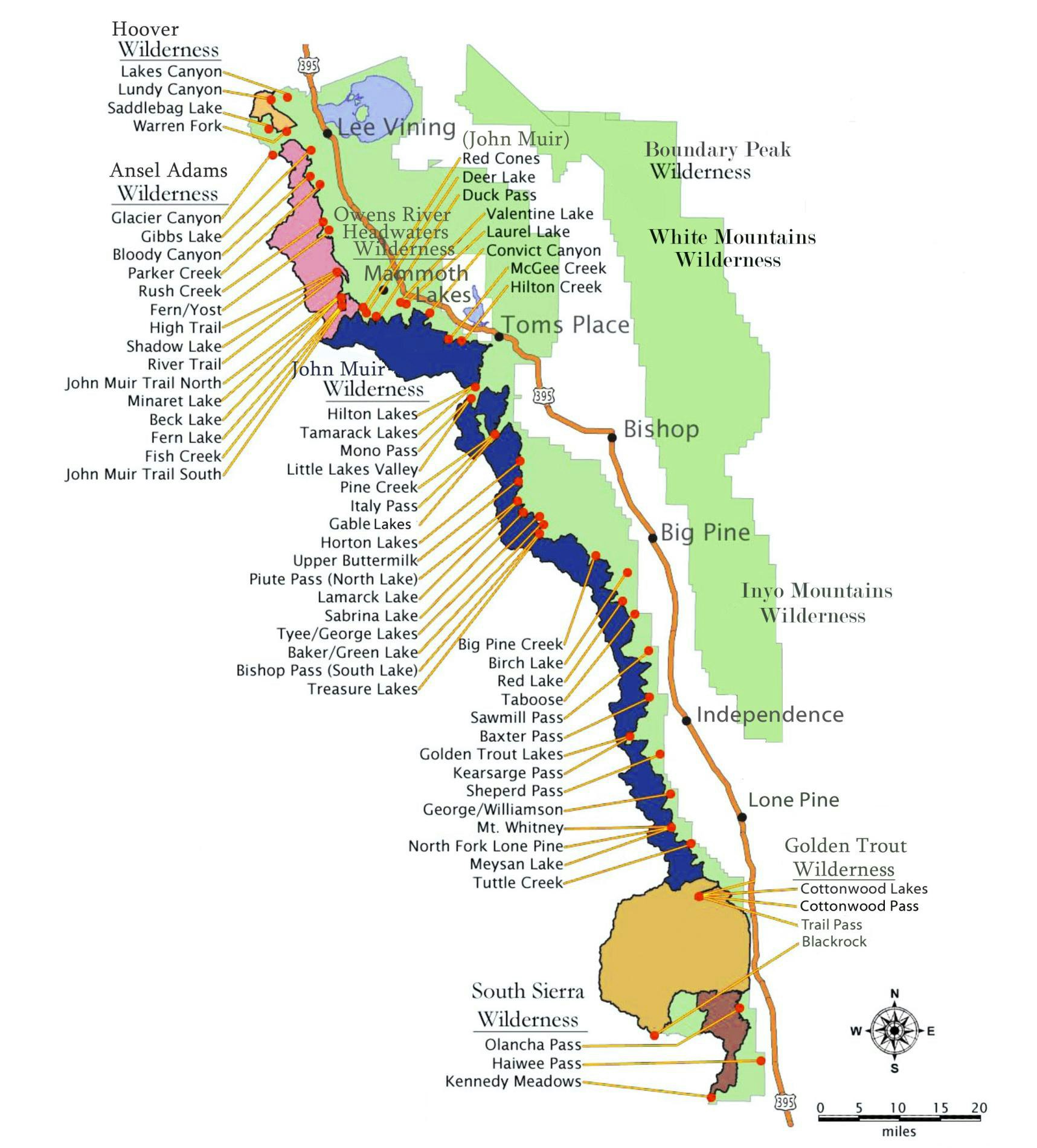
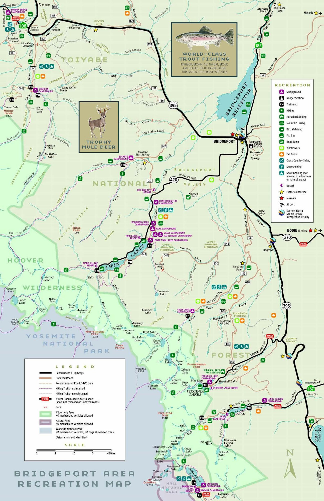
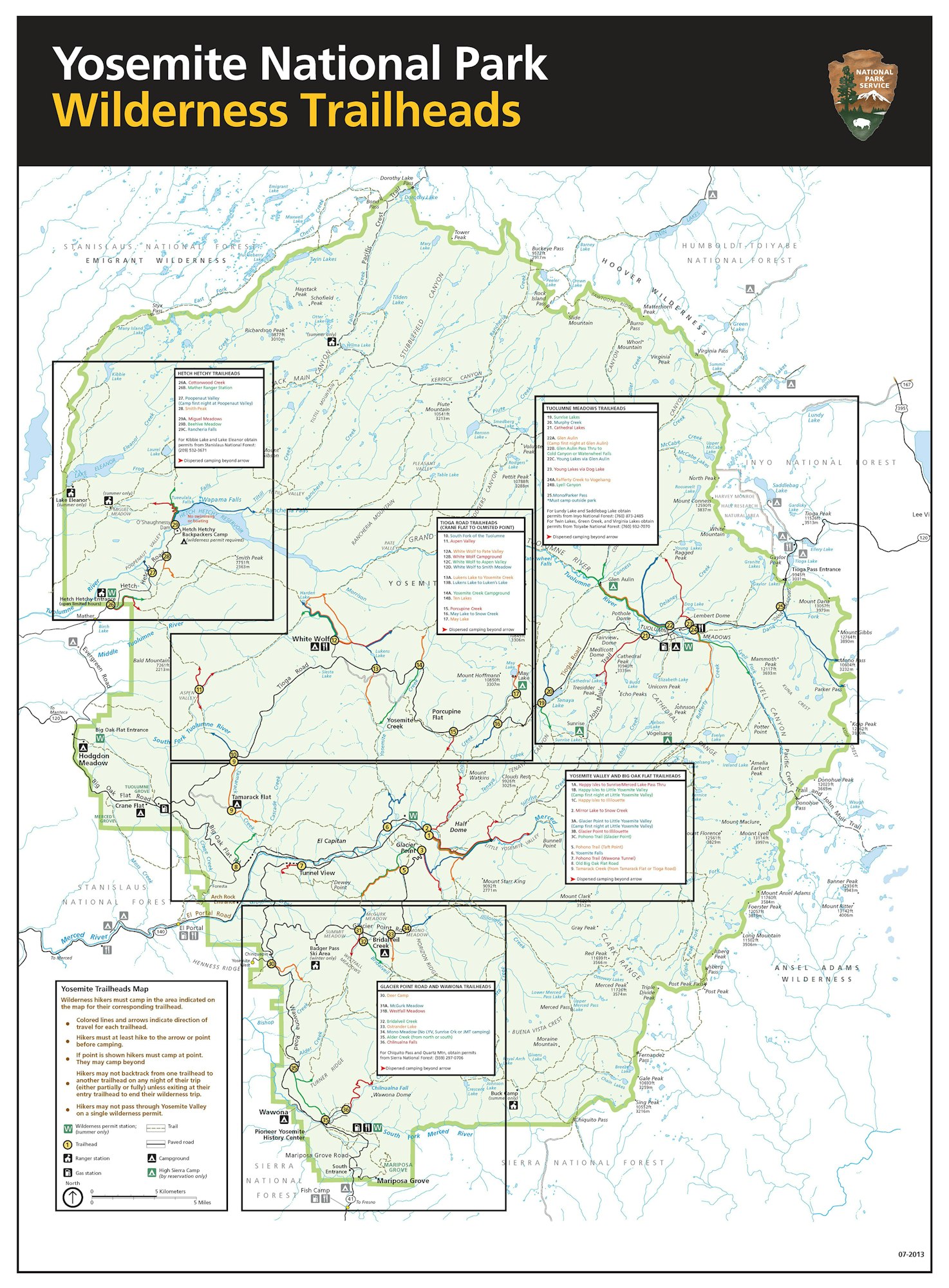
The Inyo and Toiyabe National Forests contain dozens of trails that funnel down towards the US 395 corridor. The maps below will help guide you to the community closest to the trail. Eastern Sierra Transit does not offer trailhead transportation but there are other companies that do. The website climber.org maintains an up to date list of trailhead transportation options.
Below are maps of the Inyo National Forest, Bridgeport Recreation Area, and the Yosemite Area Trailheads.


